Your Ultimate Guide to Hiking the Westman Islands in Iceland
Picture this: you’re standing on the rim of a volcano that erupted just 50 years ago, while puffins soar overhead like feathered confetti with the Atlantic Ocean as the backdrop. This isn’t a scene from a fantasy novel. It’s your reality when hiking the Westman Islands off Iceland’s southern coast.
The Westman Islands offer otherworldly adventure where volcanic trails meet some of Europe’s largest puffin colonies. From late May through early August, you’ll see these “sea parrots” in their natural habitat while traversing volcanic terrain. Whether you’re scaling Heimaklettur’s peak or exploring the still-warm slopes of Eldfell volcano, every step reveals something extraordinary.
In this guide, you’ll discover how to navigate the Westman Islands’ trails, time your visit perfectly for wildlife encounters, and prepare for this unique volcanic hiking experience.
Discovering the Westman Islands Archipelago
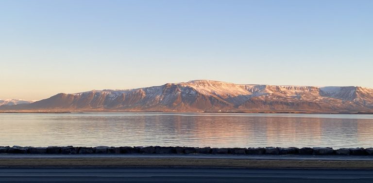
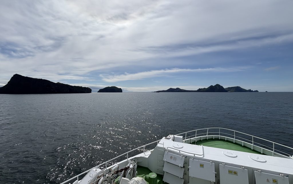
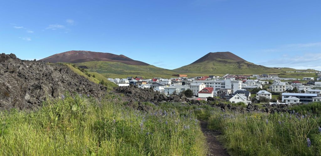
The Westman Islands volcanic archipelago consists of 15 islands scattered off Iceland’s south coast, formed entirely by underwater volcanic eruptions over thousands of years.
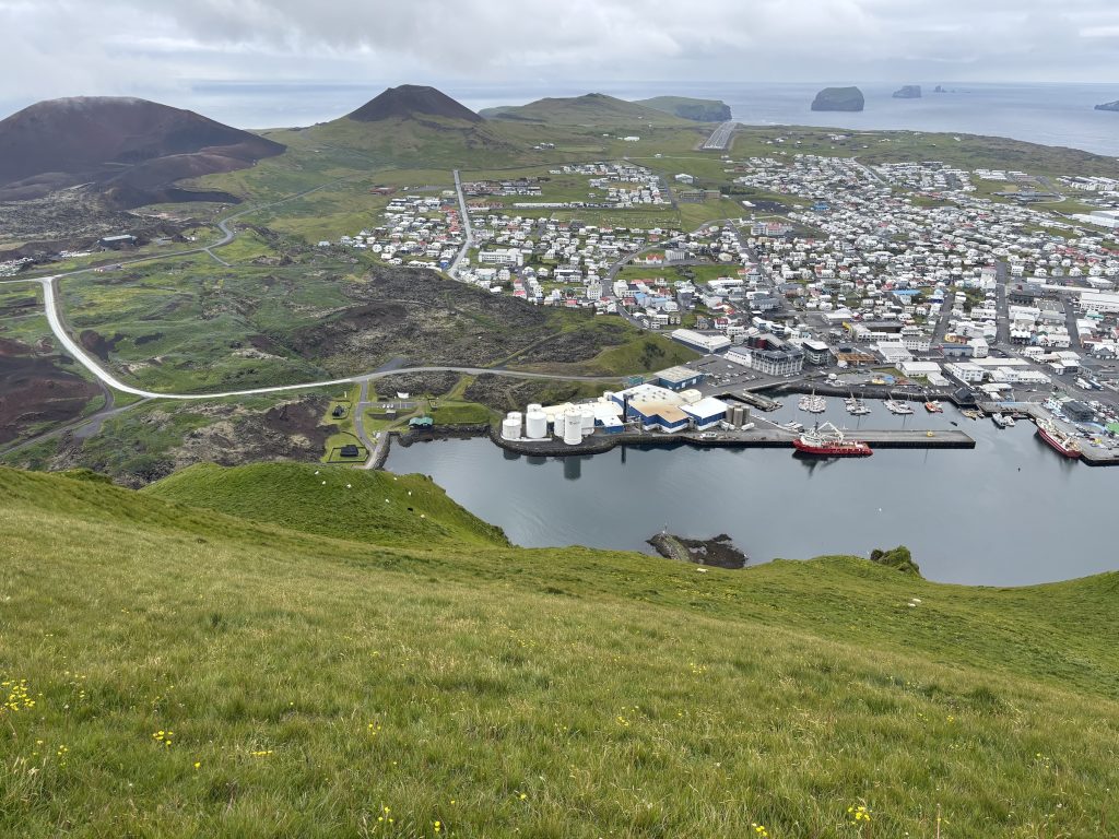
Heimaey is the only permanently inhabited island, hosting the town of Vestmannaeyjabær. As you explore, you’ll witness dramatic proof of the Earth’s raw power. The Eldfell volcano erupted suddenly in 1973, reshaping the island’s landscape overnight and creating fresh geological formations that continue captivating visitors today.
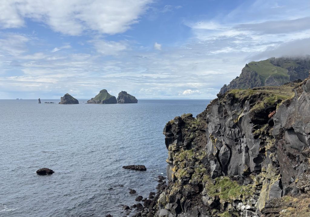
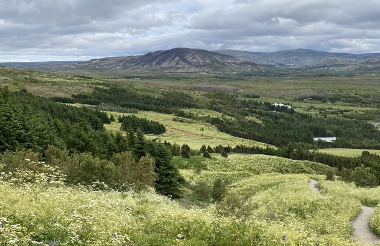
The archipelago’s volcanic origins create breathtaking scenery around every corner. You’ll discover towering sea cliffs, unique lava formations, and black sand beaches that showcase nature’s artistic capabilities.
Ferry Transportation Information
Getting to Westman Islands requires a ferry, which should be booked in advance.
Primary Route – Landeyjahöfn:
- Journey time: 45 minutes
- Peak season departures: Up to 7 daily
- Sailing times: 8:15, 10:45, 13:15, 15:45, 18:15, 20:45, and 23:15
Buy tickets on the official ferry website.
The ferry starts departs from here. There is lots of free parking near the ferry port.
You can also take your car with you to Heimaey but it costs extra, car spaces are limited, and you don’t really need the car. The island is small and you can easily hike across the whole of it.
Alternative Route – Þorlákshöfn:
- Journey time: 3 hours, the route used during bad weather. But then you might want to skip the journey altogether as it will be a bumpy ride!
Essential Ferry Tips
Advance booking is crucial, especially during summer months when demand peaks. You can easily plan a day trip using morning departures and evening returns. This will still give you enough time to explore Heimaey’s volcanoes, puffin colonies, and the harbor town.
However to explore all hiking trails on Heimaey, it’s best to stay overnight. There aren’t that many hotels in Vestmannaeyjabær so it’s best to book in advance.
Weather conditions can affect ferry schedules, so check current sailing information before departing.
The ferry ride is short, only 45 minutes or even less. There is a bar / cafe on the ferry and the prices are reasonable for Iceland. Seats aren’t booked, just arrive early and grab whatever you like.
Wildlife Paradise in the North Atlantic
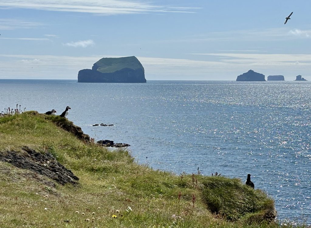
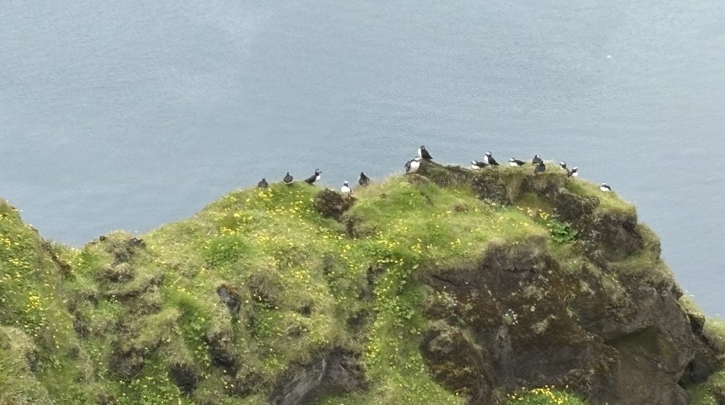
Puffins are the main reason people, including hikers, travel to Westman Islands.
From late May through early August, you can see millions of puffins return to nest on these North Atlantic islands . Peak activity occurs during June and July, transforming the clifftops into a bustling seabird metropolis. For optimal viewing, hike to the cliffs during early morning or dusk hours when puffins are most active. However, at any other time of the day, you’ll also see them on the cliffs.
Puffins aren’t the only cliff inhabitants on the Westman Islands. You’ll also see guillemots, razorbills, and fulmars, each species occupying distinct ecological niches. These seabirds create a symphony of calls and constant motion that captivates photographers and wildlife enthusiasts alike.
Best Viewing Times:
- Early morning (6-9 AM)
- Evening hours (6-9 PM)
- Peak season: June-July
Marine life adds another dimension to your wildlife experience. Seals frequently hang out on rocky shores visible from coastal trails, while whales occasionally grace the waters during summer months. Sometimes you can even spot whales from the ferry.
Responsible Viewing Practices:
- Maintain 10+ meter distance from nesting areas
- Use binoculars or telephoto lenses for close observation
- Stay on designated trails
- Keep voices low to avoid disturbing wildlife
You can hike on your own to several cliffs where puffins nest. Just be careful, getting to close to the nests doesn’t just disturb the birds. It’s also dangerous for you because cliffs are very high and the edge can give in. Falling from cliffs means certain death and sadly some tourists died that way.
Time your visit between late May and early August for guaranteed puffin encounters. Early June through mid-July offers the most photogenic opportunities, as you have nearly 24-hour daylight and the number of birds is at the peak.
Hikes in Westman Islands
On Heimaey (“home island” in Icelandic), the main Westman Island, you can do three main hikes:
- Edlfell volcano hike
- Heimaklettur hike
- Coastal hike to puffins
Let’s look at each of these trails in detail.
Conquering Eldfell Volcano: A Journey Through Fire and Time
On January 23, 1973, Eldfell volcano erupted without warning, forever changing Heimaey island’s landscape. This catastrophic event, which marked its 50th anniversary in 2023, saw the resilient community successfully divert lava flows to save their harbor. Still, lava and ash destroyed over 400 houses.
You can now easily and safely hike to the top of Eldfell volcano’s caldera.
Trail Specifications and Safety
The moderate-difficulty trail begins near Heimaey harbor, winding through lava fields that tell the story of geological rebirth.
You’ll traverse approximately 3-4 kilometers of volcanic terrain, gaining 221 meters in elevation. The path requires hiking boots due to jagged volcanic rock surfaces and loose scree sections. Some people still hike in sneakers but be warned that they might get damaged by sharp lava stones.
The trail is well marked. However, it’s still possible to get off-track (we did!) because there are several ways to the top. The most clear and easy path is from the parking lot.
We did this hike with a 6-year old and he didn’t complain. It was quite fun for him to look at different colors of lava and imagine which ones were hotter during the eruption.
Photography and Views
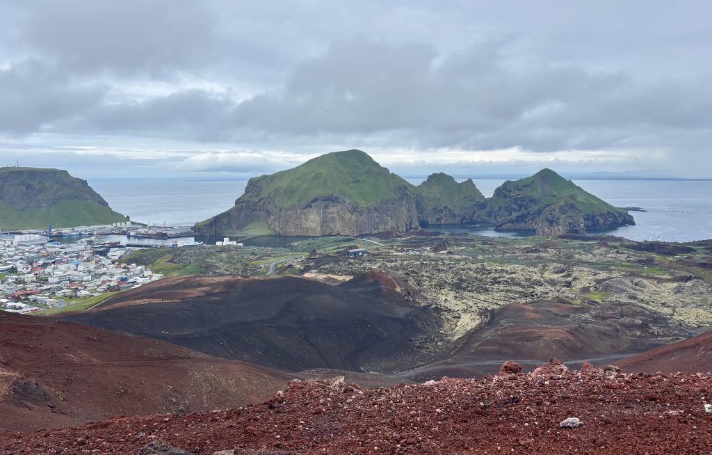
Your camera will capture contrasts between red lava formations and emerald grassy slopes in other parts of the island. The summit rewards you with panoramic views of the Westman Islands archipelago and mainland Iceland’s glacial peaks on clear days.
Weather and Timing Considerations
Weather changes rapidly here, so check conditions before departing. Early morning hikes offer the best lighting for photography and typically calmer winds. Avoid hiking during storms or when visibility drops below 50 meters.
Geological Interpretation
As you ascend through rope-like pahoehoe lava formations and chunky aa lava fields, you’re witnessing geological processes that shaped our planet.
This unique hiking experience places you directly atop recently-formed volcanic terrain, making you a witness to Earth’s ongoing creation story.
Heimaklettur Mountain: Your Ultimate Climbing Challenge
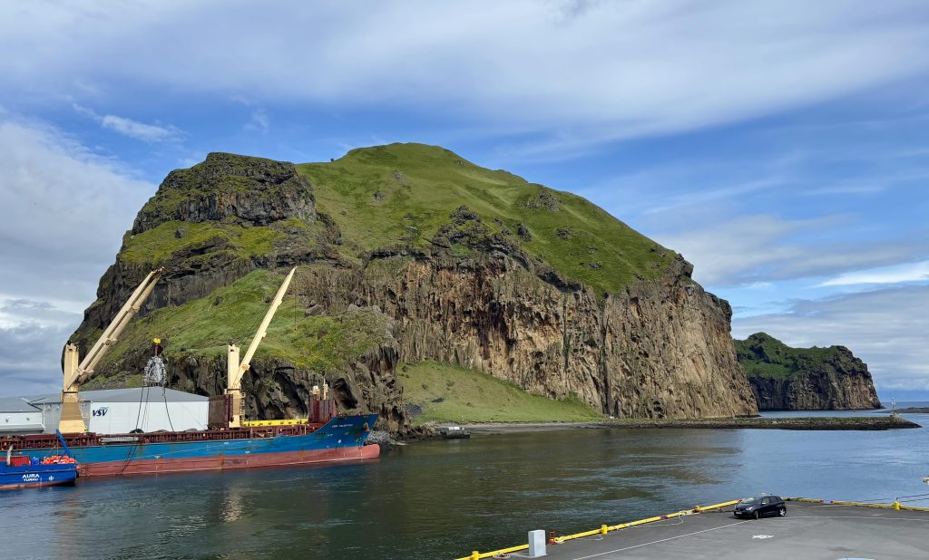
Standing at 283 meters (928 feet), Heimaklettur (“home rock” in Icelandic) is the first thing you see when you arrive in Heimaey. The rock dominates the Westman Islands as its highest peak, offering one of Iceland’s most thrilling climbing experiences. This isn’t your typical hiking trail – it’s a true adventure that demands respect and preparation.
The Challenging Vertical Ascent
Your journey to the summit involves navigating challenging sections equipped with stairs, ladders, ropes, and chains. Recent infrastructure improvements include new safety ladders, making the climb more manageable while maintaining its adventurous character. However, this mountain demands physical fitness and mental fortitude.
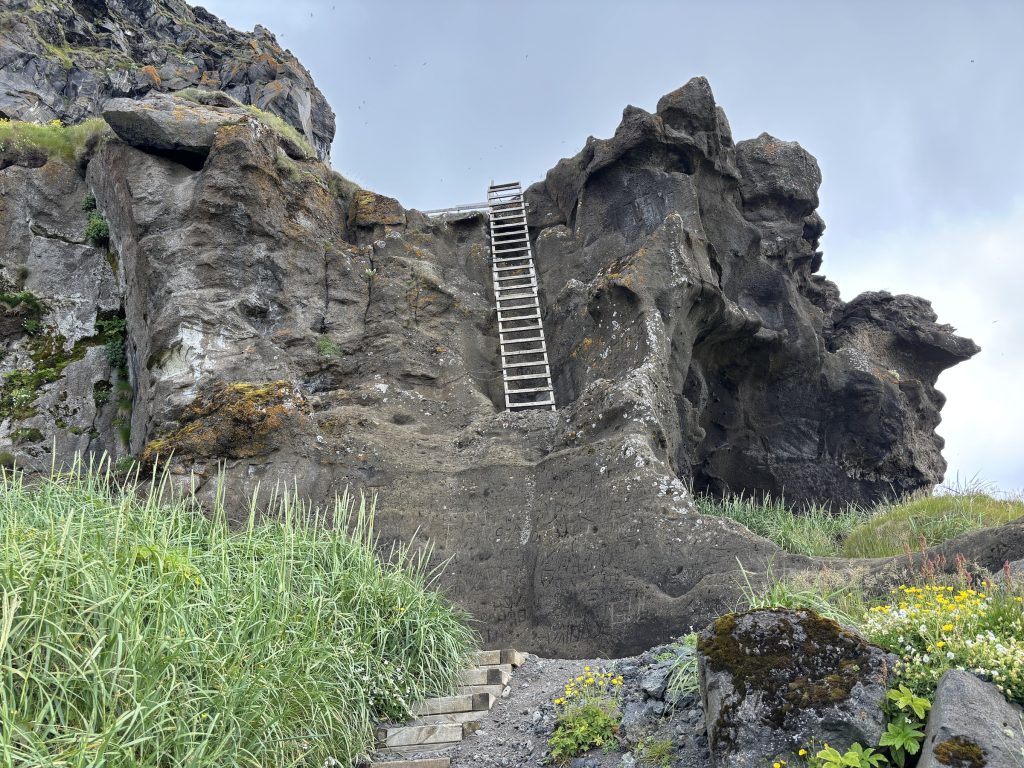
Warning: This climb is not recommended for those afraid of heights or lacking physical fitness. The exposed sections require you to use fixed ropes and chains, with significant (and almost constant) exposure to steep drops. To be honest, this trail should be a via ferrata.
The first ladder starts right after the trailhead (which is behind some work area). If you find the ladder scary, please don’t go further. It only gets more exposed.
I’ve done this hike on my own and didn’t meet many people on the trail. That was good because you can’t really give way on a ladder!
Timing Your Adventure
Fit hikers typically complete the ascent in 45 minutes to one hour, while the descent takes approximately 30 minutes. However, remember that “the descent is often more difficult than the ascent”. Many hikers find going down more challenging due to the steep, exposed terrain and the psychological difficulty of descending heights.
Keep in mind that the walk from the town to the trailhead is another 30 minutes. It’s not very fun and goes through various work areas in the harbor. To get there faster, you can take a Bolt scooter, the only “public” transport on the island.
Summit Rewards
Your efforts are rewarded with spectacular 360-degree views encompassing the entire Westman Islands archipelago and the Icelandic mainland. The summit features a guestbook where you can record your achievement and serves as a popular picnic spot for those who conquer the climb.
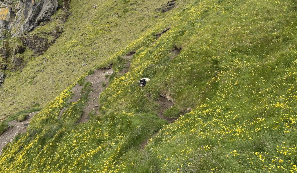
Near the top you’re almost guaranteed to see sheep. I’ve heard that they are roped up there. This one that is particuarly friendly and keeps hanging out near the trail.
And on the way up and down you’ll see thousands of puffins. For them, the exposed cliffs are home. For you, turning your head to see them might be a bit disorienting… take care and don’t go off trail.
Safety Considerations
Before attempting Heimaklettur, ensure you’re physically prepared and comfortable with heights. Bring appropriate footwear (ensure a good grip), check weather conditions (there is always wind at the top), and consider the challenging infrastructure.
It’s not recommended to do this trail when it rains let alone snows.
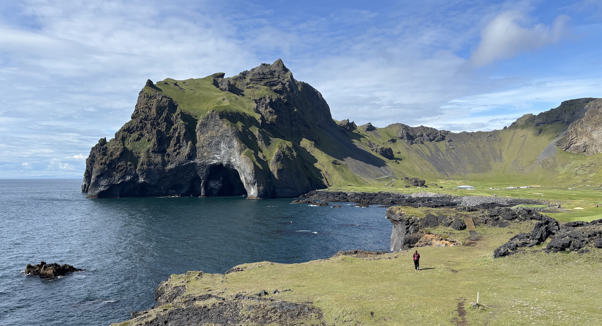
Coastal Circuits and Hidden Trails
Beyond the famous volcanic peaks, the Westman Islands have spectacular coastal trails where ancient lava meets the North Atlantic. These trails offer great views of the cliffs and sea birds that nest on them.
You’ll find route options ranging from complete 8-kilometer island circumnavigations to family-friendly 2-kilometer coastal segments.
The shorter paths are perfect if you’re traveling with children or prefer gentle exploration. We did this section with a 6-year old and he only mildly complained on the way back when there were no puffins to entertain him.
Wind exposure is significant along these coastal routes, so you’ll need weather-appropriate layers. The ever-changing light conditions create exceptional photography opportunities and can also give you a sunburn! In the summer, the daylight is almost endless and you’re exposed to UV even if it’s cloudy.
You can start the coastal trail straight from the town. Just go to the camping area and follow the trail through the golf fields. Or you can take a taxi or scooters to get closer to this part, where the puffins start to nest.
The trail isn’t that well-marked. But it is well-trodden and visible, the locals just use it for their daily walks.
You can also book a Westman Islands tour from Reykjavik, which will take care of transportation and making sure you don’t miss anything on the island.
Timing Your Adventure: Seasons and Preparation
Optimal Season: Plan your visit between May and September when weather conditions, ferry schedules, and wildlife activity align perfectly. This window offers the most reliable access and comfortable hiking conditions for exploring the volcanic terrain.
Wildlife Timing
Puffin enthusiasts should target April through August when these iconic seabirds nest on coastal cliffs. Peak viewing occurs in June and July when puffin colonies are most active and accessible for photography.
Ferry Schedules and Booking
Summer schedules feature up to 7 daily departures from Landeyjahöfn, providing flexible timing for your adventure. Book ferry tickets well in advance, especially during peak puffin season (June-July) when demand is highest. It’s better to avoid the weekends, when the locals travel to and from the island.
If you stay overnight, book the hotel in advance. The camping area doesn’t require booking for a tent. Keep in mind, that except for a few bars, everything closes early. There isn’t much do apart from hiking.
Weather Preparation Essentials
Pack layered clothing as conditions change rapidly on exposed sections:
- Waterproof outer shell
- Insulating mid-layers
- Moisture-wicking base layers
- Windproof gloves and hat
Also don’t forget your swimsuit. The swimming pool is quite nice but closes at 6pm on weekends.
Volcanic Terrain Gear
The dark volcanic rock absorbs heat, requiring specialized preparation:
- Extra water (minimum 2 liters per person)
- Sun protection (hat, sunglasses, SPF 30+)
- Sturdy hiking boots or trail sneakers with good grip
Safety and Environmental Guidelines
- Check weather forecasts before attempting technical routes
- Carry emergency communication devices
- Stay on marked trails to protect fragile ecosystems (and yourself!)
- Pack out all waste following Leave No Trace principles
Weather conditions on Westman Island ridges and coastline can deteriorate even faster than on mainland Iceland. Always prioritize safety over summit goals, and be prepared to turn back if conditions become dangerous.

![Glacier Hiking in Iceland – A Full Guide [2025]](https://hikingclub.is/wp-content/uploads/2025/05/IMG_0745-768x420.jpeg)